Day 1: PARO INTERNATIONAL AIRPORT – PARO (L/D)
Upon arrival at Paro International airport, you will be met by your guide. In the afternoon, you will have an opportunity to explore the beautiful town of Paro.
Dinner and overnight at your hotel in Paro.
Day 2: TAKTSANG MONASTERY OR TIGER’S NEST (B/L/D)
After breakfast, we will drive you to the trail head to commence a climb through beautiful pine forest. We will stop for light refreshments at the Taktsang cafeteria before walking on to the famous, Taktsang monastery or Tiger’s Nest. The primary Lhakhang or main temple was built around Guru Rimpoche’s meditation cave in 1684 by the Penlop of Paro, Gyalse Tenzin Rabgay. This incredible monastery clings to the edge of a sheer rock cliff that plunges 900 m into the valley below. Legend has it that Guru Padmasambhava, the tantric mystic who brought Buddhism to Bhutan in 747 AD, flew here on the back of a flying tiger, Dorji Drolo from Kurtoe Singye Dzong in the east.
After lunch, we will visit Ta Dzong (built in 1656 and renovated in 1968), an ancient watchtower, which now houses the National Museum. Below the museum is the Rinpung Dzong (literally meaning “Heap of Jewels”), the centre of civil and religious authority in this valley, built in 1646 by Zhabdrung Ngawang Namgyal.
Dinner and overnight at your hotel in Paro.
Day 3: PARO – GUNITSAWA VILLAGE – SHARNA ZAMPA (Distance: 40min, 80m descent, camp altitude 2580m) (B/L/D)
After breakfast, drive to Drugyal Dzong, a ruined fortress 16km from Paro town. Although it is now in ruins, this dzong has great historical importance for the people of Bhutan. It was a place where the Bhutanese finally defeated the Tibetan invasion. On a clear day you can view sacred Mt. Jomolhari (mountain of Goddess) at an altitude of 7329m.
The 10-day trek begins at Gunitsawa Village where you pass the army post.
The campsite is on the opposite side of the river, not far from Gunitsawa.
Dinner and overnight camping at Sharna Zampa.
Day 4: SHARNA ZAMPA – THANGTHANGKHA (Distance: 22km, 7-8hrs, 770m ascent, 10m descent, camp altitude 3610m) (B/L/D)
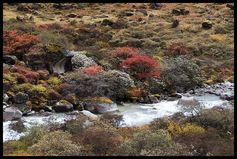
On this long day, the trail continues with lots of small ups and downs following the river through a heavily forested area with a few isolated farmhouses.
After going uphill through the river valley, the valley finally narrows gradually to a mere path which descends to a meadow where a camp will be set up. From here, if weather permits, you have the first great view of Mount Jomolhari.
Dinner and overnight camping at Thangthangkha.
Day 5: THANGTHANGKHA – JANGOTHANG (Distance: 19km, 5-6hrs, 480m ascent, camp altitude 4080 m) (B/L/D)
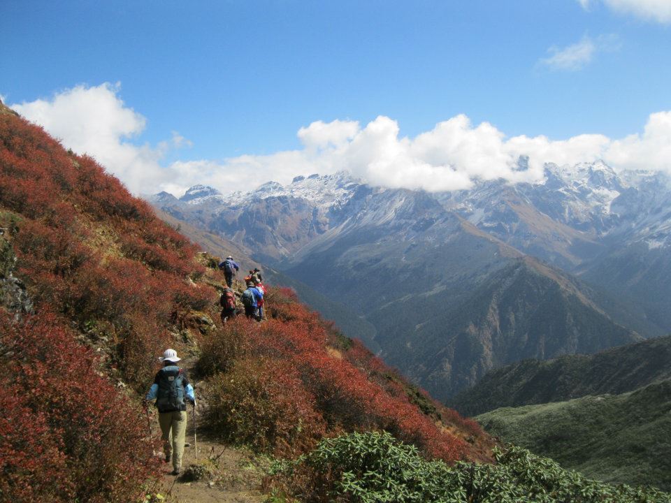
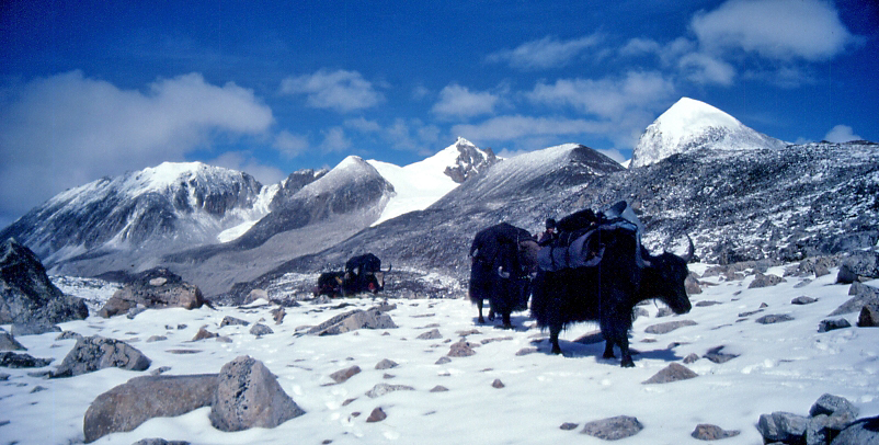
If you did not see Mt. Jomolhari the previous evening, you will still have a chance to get a great view early this morning. This morning the trek continues up the Paro Chhu valley that widens into patches of alpine meadow and scanty growths of forest. You will cross an army checkpoint along the way and enjoy a spectacular view of high mountain ridges and snow-capped peaks. In this area yaks and their herders’ homes become a regular feature of the landscapes.
Passing the villages of Soe, Takethang and Dangochang is another asset on this day. After reaching Jangothang, one of the most beautiful campsites of the Himalayas, you will again have a spectacular view of Mount Jomolhari.
Dinner and overnight camping at Jangothang.
Day 6: JANGOTHANG HALT (B/L/D)
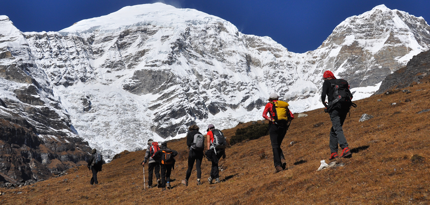
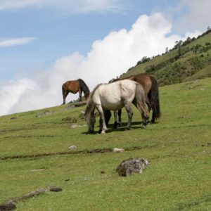
The rest day in Jangothang provides plenty of possibilities for day hikes with great views of lakes and snow capped mountains such as Jomolhari and Jichu Drake. There are good chances to spot some blue sheep on the upper slopes of the valley.
Jangothang is a perfect environment for your acclimatization. You can also trek up to Tosoh or hike around the area. There are good short hiking trails in three directions. Jomolhari and its subsidiary mountain chains lie directly west, Jichu Drake to the north and there are a number of unclimbed peaks to the east.
Dinner and overnight camping at Jangothang.
Day 7: JANGOTHANG – LINGSHI (Distance: 16km, 6-7hrs, 840m ascent, 870m descent, camp altitude 4010m) (B/L/D)
This is one of the longest days of the trek. A short distance from the camp the trail begins climbing rapidly for about half an hour and then becomes a gradual ascent to the Nyilila pass at 4870m. While on the climb enjoy the surroundings. You might see herds of blue sheep grazing on the slopes of the mountains. From the pass you will have spectacular views of Mount Jomolhari, Jichu Drake and Tsherimgang, all of them rising above 7000m. It’s a gradual descent to the camp where you will pass by some yak herders’ tents, made from yak wool. The herders use these tents while traveling to various pastures for their yaks. As you come down into the Lingshi basin, a beautiful U-shaped valley, you get a wonderful view of Lingshi Dzong on clear days. Tsherimgang and its glaciers rise up at the north end of the valley. The campsite is next to a stone hut you reach just before Lingshi Dzong.
Dinner and overnight camping at Lingshi.
Day 8: LINGSHI – CHEBISA (Distance: 10km, 5-6hrs, 280m ascent, 410m descent, camp altitude 3880m) (B/L/D)
Today is the shortest walking day, and you can really take it easy. Shortly after starting you will reach a chorten below Lingshi Dzong. Here, you have the choice of staying on the main trail or taking a detour up to the Lingshi Dzong (4220m), which sits right atop a high ridge. In addition to a very special atmosphere of mystic tranquility, Lingshi Dzong provides a great view over the valley. After Lingshi Dzong you will be passing the villages of Lingshi and Goyul. In Goyul, the stone houses are clustered together to form a small compact village that is unusual in Bhutan where settlements are usually scattered. On reaching the campsite at Chebisa you will have plenty of time to visit the village houses if you feel up to it. There is also a beautiful waterfall located behind the village that is worth visiting.
Day 9: CHEBISA – SHOMUTHANG (Distance: 17km, 6-7hrs, 890m ascent, 540m descent, camp altitude 4220m) (B/L/D)
The morning starts with a long ascent behind Chebisa Village (2-3hrs) through a wide pastureland towards Gobu La pass (4410m). On the way, you will see a few people herding yaks. There is also a great chance to spot large herds of blue sheep above the trail. After crossing Gobu La pass, you descend into the valley, then climb again a little bit, before descending again to Shakshepasa (3890m), a large U-shaped valley. Climbing from here you will finally reach the campsite at Shomuthang, above a river, which is a tributary of the Nochu River.
Dinner and overnight camping at Shomuthang.
Day 10: SHOMUTHANG – ROBLUTHANG (Distance: 18km, 6-7hrs, 700m ascent, 760m descent, camp altitude 4160m) (B/L/D)
The trek begins by climbing up the valley to view Kang Bum (6526m) and some edelweiss. After two hours of climbing you will reach the Jhari La pass at (4750m) from where you get the first glimpse of Sinche La (5005m). We drop steeply down a forest trail to the Tsarigathang valley, where herds of Takin roam, then cross a knee deep river before climbing up Robluthang where we camp.
Dinner and overnight camping at Robluthang.
Day 11: ROBLUTHANG – LIMITHANG (Distance: 19km, 6-7hrs, 850m ascent, 870m descent, camp altitude 4140m) (B/L/D)istance: 8km, 3-4hrs, 500m ascent, 930m descent) (B/L/D)
The trek starts out with an initial 40-60 minutes ascent before gradually rising for another 1.5 hours through a boulder field. It is then a 1 hour steep ascent before reaching Sinche La pass (5005m) – the final and highest pass on the trek if you don’t intend to continue the Snowman Trek from Laya onwards. As you descend the far side of the pass you will see an impressive terminal moraine and a glacial lake at the foot of the valley. You can see classic examples of lateral moraines where the glacier has pushed rocks up both sides of the valley. Below the moraine, you cross Kango Chhu and soon reach the Limithang campsite. The peak of Gangchhenta towers over the campsite even though it’s quite a distance away. Eagles, griffin vultures, blue sheep and yaks abound in this area.
Dinner and overnight camping at Limithang.
Day 12: LIMITHANG – LAYA (Distance: 10km, 4-5hrs, 60m ascent, 340m descent, camp altitude 3840m) (B/L/D)
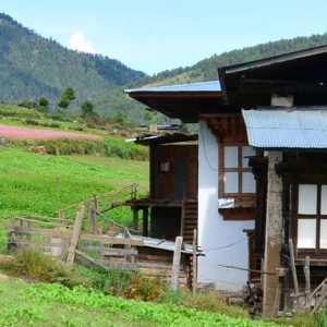
Today, you walk downhill all the way along a narrow, winding river valley. After a long time, the trail takes you through a densely forested region. The trail leads you to the west side of Laya village. From the west of the village you will have spectacular views of Mount Gangchhenta and Masagang. In the village centre is a community school and a basic health unit with a telephone connection.
Dinner and overnight camping at below the school in Laya.
Day 13: REST/ACCLIMATIZATION DAY IN LAYA (B/L/D)
If you have trekked from the Paro Valley you should spend a day recuperating from the trek to Laya and preparing yourself for the rest of this challenging but spectacular trek. You should also walk up to Laya to acclimatize, and not just stay at the trail junction to Lunana. It’s worthwhile to stay one day in Laya just for the great views from Laya and its extraordinary inhabitants.
Dinner and overnight camping in Laya.
Day 14: LAYA – RHODUPHU (Distance: 19km, 6-8hrs, 1,030m ascent, 750m descent, camp altitude 4160m) (B/L/D)
From Laya you descend to an army camp and continue following the river till the turn off point to Rhoduphu. After lunch the climb continues through rhododendron bushes till you reach the camp at Rhoduphu just next to the Rhodu Chhu.
Dinner and overnight camping at Rhoduphu.
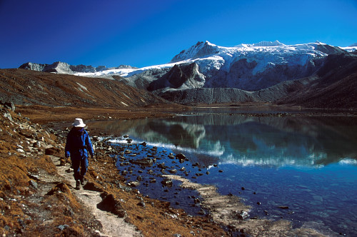
Day 15: RHODUPHU – NERETHANG (Distance: 17km, 5-6hrs, 740m ascent, camp altitude 4900m) (B/L/D)
After following the river for about half an hour you will have a steady climb to a high open valley at 4600m and then further up to Tsomo La (4900m). Tsomo La offers a superb view of Lunana, Mt. Jomolhari and Jichu Drake, and the Tibetan border. The route then crosses a flat, barren plateau at about 5000m. The campsite at Narethang is towered by the peak of Gangla Karchung (6395m).
Dinner and overnight camping at Narethang.
Day 16: NARETHANG – TARINA (Distance: 18km, 5-6hrs, 270m ascent, 1200m descent, camp altitude 3970m) (B/L/D)
From the camp you will climb for about an hour to Gangla Karchung La pass (5120m). The view from this pass is breathtaking and the whole range of mountains including Jekangphu Gang (7100m), Tsenda Kang and Tseri Gang (7300m) can be seen. The pass descends along a large moraine. Again one has great views: a massive glacier descends from Teri Kang to a deep turquoise lake at its foot. Up here a glacier lake burst through its dam in the early 1960s, causing widespread damage and partially destroying Punakha Dzong. Finally, it is a very long descent through thick rhododendron forest into the Tarina valley, where you will find several good campsites along the Tang Chhu.
Day 17: TARINA – WOCHE (Distance: 17km, 6-7hrs, 270m ascent, 330m descent, camp altitude 3910m) (B/L/D)
The walk leads down through conifer forests following the upper ridges of the Pho Chhu, passing some impressive waterfalls. The trail then climbs over a ridge and drops to Woche, a settlement of a few houses, the first village in the Lunana region.
Dinner and overnight camping at Woche.
Day 18: WOCHE – LHEDI (Distance: 17km, 6-7hrs, 980m ascent, 1190m descent, camp altitude 3700m) (B/L/D)
The trek starts through juniper and fir forests, and further ahead, through rhododendron bushes. Climb up to Keche La pass (4650m) where one can have a great view of surrounding mountains again. After the pass, descend to the riverside walking through a village with a stunning view of Table Mountain and others. Follow up the river till Lhedi Village. Lhedi has a basic health unit, a school and wireless telephone connection.
Dinner and overnight camping at Lhedi.
Day 19: LHEDI – THANZA (Distance: 17km, 7-8hrs, 450m ascent, camp altitude 4150m) (B/L/D)
In clear weather, you will have great views of Table Mountain (7100m). Around lunchtime you will pass the small village of Chozo (4090m) which has a dzong still in use. Reaching Thanza you will have a great view of Table Mountain which forms a 3000m high wall of snow and ice behind the village. Although, there are possibilities to camp directly at Thanza, most groups prefer to camp in Thoencha.
Dinner and overnight camping at Thanza or Thoencha.
Day 20: REST DAY AT THANZA (B/L/D)
In Thanza walk around and experience some village life or climb up the ridge for fascinating views of lakes and mountains. But as it takes time to arrange fresh yaks for the rest of the trek, you might have to spend one day at Thanza anyway.
Dinner and overnight camping at Thanza.
Day 21: THANZA – DANJIT (Distance: 8km, 3-4hrs, 80m ascent, camp altitude 4230m) (B/L/D)
From Thoencha, the trail climbs up to a large boulder from where you will have excellent views of Thanza, Thoencha and Choso village and the surrounding mountains. After a few hours of relatively flat and easy walking, you will reach a yak meadow with some yak herders’ huts. It is an excellent campsite with a great chance to spot some blue sheep on the hills above. A trail junction near the campsite will give you the choice between the routes up to Gangkar Puensum base camp, and further on to Bumthang or to Sephu (Trongsa). Both routes are described in our website.
Dinner and overnight Camping at Danji.
Day 22: DANJI – TSHOCHENA (Distance: 12km, 5-6hrs, 980m ascent, 240m descent, camp altitude 4970m) (B/L/D)
Having chosen the route to Sephu, the trek crosses a creek and after a long climb, you will reach Jaze La (5150m) with spectacular panoramic mountain views. The path then descends between snow covered peaks and a couple of small lakes to the campsite near the shore of Tshochena Lake.
Dinner and overnight camping at Danji.
Day 23: TSHOCHENA – JICHU DRAMO (Distance: 14km, 4-5hrs, 230m ascent, 150m descent, camp altitude 5050m) (B/L/D)
You follow the banks of the blue green lake before arriving at a ridge at 5100m, where there is another spectacular view in all directions. After going up and down over small hills to reach a glacial lake, the route descends first before climbing again up the next pass, the Loju La (5140m). Finally after crossing a small saddle (5100m) you will enter a wide glacial valley from where the trail descends gradually to the campsite at Jichu Dramo.
Dinner and overnight camping at Jichu Dramo.
Day 24: JICHU DRAMO – CHUKARPO (Distance 18km, 5-6hrs, 320m ascent, 730m descent, camp altitude 4600m) (B/L/D)
Right after leaving the camp you will climb through a moraine to Rinchen Zoe la (5320m). Spectacular mountain scenery with Gangkar Puensum amongst the impressive mountains is the reward for climbing the highest pass on this trek route. Rinchen Zoe peak (5650m) towers above the pass the west. Descending from the pass, the route leads into a wide valley with several lakes and goes steeply down along a moraine to the Thamphe Chhu. Here the vegetation begins to thicken again and you will see the first real trees since Lhedi. After a couple of hours you reach the campsite at Chukarpo.
Dinner and overnight camping at Chukarpo.
Day 25: CHUKARPO – THAMPE TSHO (Distance: 18km, 5-6hrs, 400m ascent, 700m descent, camp altitude 4300m) (B/L/D)
The descent continues along the river till you reach the yak herder huts at Gala Pang Chhu (4010m). From here the trail climbs steeply towards Thampe Tsho, a beautiful clear turquoise lake, with the campsite next to it.
Dinner and overnight camping at Thampe Tsho.
Day 26: THAMPE TSHO – MAUROTHANG (Distance: 14km, 5hrs, 330m ascent, 1020m descent, camp altitude 3610m) (B/L/D)
From the lake you climb steeply to the last pass on your trek, the Thampe La (4600m) with a good chance to spot some blue sheep on the way. Then the path descends to the sacred lake Om Tsho. Passing a waterfall you will reach another, smaller lake 100m below to descend steeply to the Nikka Chhu. The path finally leads through mixed forest to a large clearing on the banks of the river with a few yak herder huts at Maurothang.
Dinner and overnight camping at Maurothang.
Day 27: MAUROTHANG – SEPHU (Distance: 18km, 5-6hrs, 990m descent) – PUNAKHA (B/L/D)
On the last day of this extraordinary trek your porters will have to change from yaks to horses as the yaks will not be willing to go further down. The path follows the Nikka Chhu to reach a large grassy area overlooking the road and the villages of Sephu. You finally reach the road at the Nikka Chhu Bridge at Sephu where you will find several stores (mainly selling bamboo products) and small restaurants. From here, drive through to Punakha.
Dinner and overnight at your hotel in Punakha.
Day 28: PUNAKHA – THIMPHU (B/L/D)
After breakfast, visit the impressive Punakha Dzong which was built by Zhabdrung Ngawang Namgyal. For many years until the time of the second king, it served as the seat of the Government. Punakha is still the winter residence of Je-Khenpo.
On the way, stop a while to view Chimi Lhakhang, which was built by Lama Drukpa Kuenley (the Devine Madman) in the 15th century. He subdued the demoness with his “magical thunder bolt”. The temple is also known as “the Temple of Fertility”. Later drive to Thimphu with the journey taking about 3.5 hours via the Dochula Pass (3140 m).
In the evening, visit Tashichho Dzong, seat of the national government and the Central Monastic Body which includes the summer residence of the Je Khenpo (Chief Abbot of Bhutan).
Farewell dinner with traditional dance and overnight at your hotel in Thimphu.
Day 29: THIMPHU SIGHTSEEING – PARO (B/L/D)
After breakfast, we will drive to Dodeyna to climb through a beautiful forest track to the Tango Monastery which overlooks a forested valley and other Buddhist retreats high in the mountains. Then we visit the National Memorial Chorten built in honor of Bhutan’s late King Jigme Dorji Wangchuck before visiting the mini zoo at Motithang to see the Takin, Bhutan’s national animal. If you wish we can then visit the Handicrafts Emporium followed by shopping for souvenirs and other items in the shops of Thimphu. In the evening drive through to Paro.
Dinner and overnight at your hotel in Paro.
Day 30: PARO – PARO INTERNATIONAL AIRPORT (B)
In the morning drive to Paro International Airport and your guide will accompany you to bid you farewell.


Reviews
There are no reviews yet.